Wave Measurement Buoy
Offshore, coastal and large inland waters are subject to varying wave conditions that have the potential to become hazardous. Wave buoys measure wave height, period, and direction to provide critical data for boaters and shipping vessels, researchers, offshore construction managers or any other application where wave data is of interest. Buoys are commonly used in drifting, tethering and mooring applications.
Waves
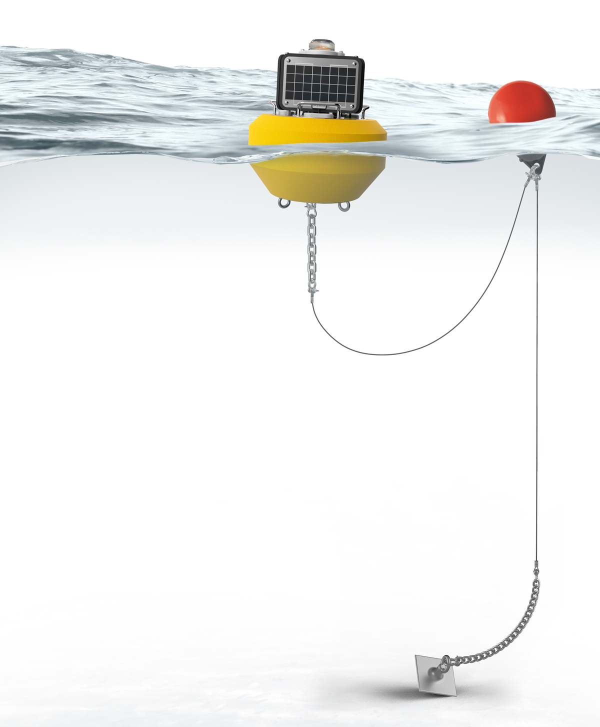
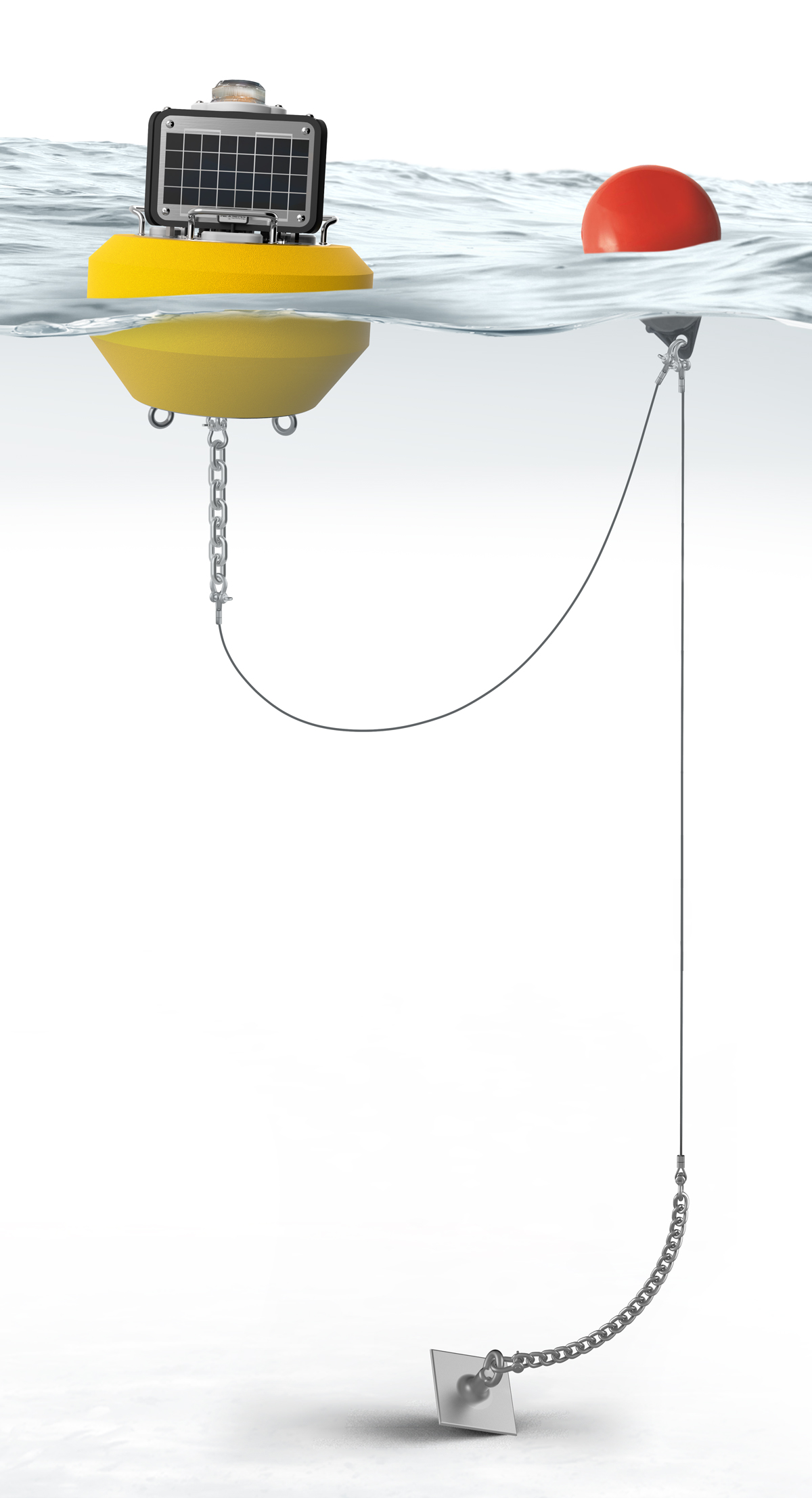
Typical Wave Buoy System
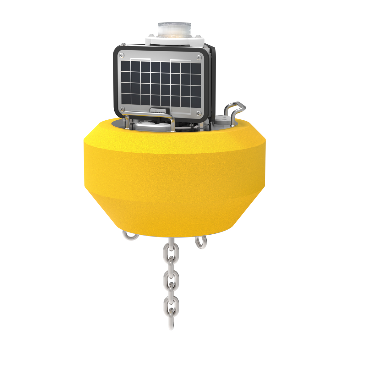
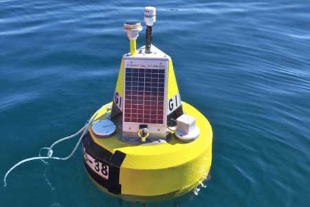
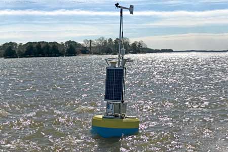
Wave buoys come in various sizes depending on the application. Small wave buoys may be used in drifting applications or other situations like nearshore monitoring where a large power supply is not necessary. For these types of applications, the NexSens CB-25-SVS buoy is an ideal option.
The CB-25-SVS features the industry-leading SeaView Systems SVS-603 wave sensor packaged in a watertight canister with data logger for transmission of wave measurements via radio, cellular or Iridium satellite telemetry. Wave height, period and direction data are sent to the WQData LIVE web datacenter. In a basic configuration, this free service allows users to securely access and analyze data, as well as share data through auto-reports. Subscription-based tiers of WQData LIVE are also available for advanced reporting, alarming, and data sharing including automated export, API and public portal options.
External sensor ports with wet-mate connectors on the CB-25-SVS logger canister support GPS, meteorological, and water quality sensors for maximum flexibility. The compact buoy has a diameter of 18” (46 cm) and total weight of just 30 lb (13.6 kg). The small size simplifies deployment, and eye bolts allow for flexible mooring or tethering options. Otherwise, the buoy may be sent adrift for ocean research applications.
For more advanced oceanographic measurements, the SVS-603 wave sensor may be integrated into larger NexSens buoy platforms such as the CB-950 and CB-1250, which have large solar panels and battery capacity to support advanced measurements with many sensor types including meteorological stations, current profilers and water quality sensors.
Contact a NexSens Applications Engineer today to discuss your wave measurement application.
Case Studies

Sturdy Little Buoy, Tremendous Predictive Power
Two solitary data buoys floating off the storm-tossed Lake Superior shore near Munising and Granite Island were sudden stars in 2017. That October, they captured the largest waves ever measured on the Great Lakes—each 28.8-foot high—during a storm that claimed the lives of two people swept off rocks. This attention-getting event shows how buoy data help managers and the public comprehend the otherwise unimaginable force of a wild Lake Superior storm that caused six figures in damage along the coast. However, these beacons provide critical wave data throughout the field season, even when the waves aren’t quite so formidable.
Read More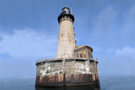

A New Kind of Sentinel on Lake Superior
For more than 100 years, the Stannard Rock Lighthouse has kept a watchful guard over Lake Superior. But now, a new weather buoy is joining the watch in a remote part of Lake Superior, providing much-needed weather data to local mariners, the National Weather Service (NWS), and researchers. Scientists from the Superior Watershed Partnership (SWP), Lentic Environmental Services (LES), and the University of Colorado-Boulder deployed the buoy on the lake in 2017. Since then, it has provided continuous data from one mile north of the lighthouse.
Read More
Lighter Buoys Mean Quicker, In-House Responses
The NOAA Chesapeake Bay Office runs an unusual set of buoys. NOAA’s Chesapeake buoys originated as part of the John Smith Water Trail—a kind of aquatic Appalachian Trail for boaters. Although the buoys are no longer used as interpretive trail markers, they are now part of a larger observing system of 10 full-time stations.
Read More